
B.D.R
The Backcountry Discovery Routes are an off-road adventure motorcycle firm based in Washington State. They have developed interconnected routes all over the western United States as well as one east coast route. They’re really doing some cool stuff over there and have plans to release even more tracks. Check them out at ridebdr.com.


Colorado
The Colorado BDR is a 675 mile remote touring route through the state, North to South or vice versa. It begins in the North at the border with Wyoming and ends at the Four Corners National Monument.
75-80% of the connected Forest Service Roads are completely passable in almost any vehicle. The rest of the trip contains sections that do require AWD at the very least, if not a low range transfer case in a true 4×4. However, lifts, lockers, and 35s are not necessary to complete such a trip as this………..in the summer, which is when we did it.


July 2020


Rigs: 2013 Chevrolet Silverado 4.8L
2002 Chevrolet Suburban 5.3L
2010 Subaru Forester 2.5L
This was easily the biggest, longest, and most difficult trip we have ever planned. We were going to be experiencing a longer amount of time in the woods, more difficult tracks, and all done in a much more remote and harsh environment. But we were prepared with the right recovery equipment, plenty of camping supplies, and also the exploration bug.
Day 1
The first two days were fairly uneventful. Day one, we all set out for the halfway point of the trip from Atlanta to Fort Collins. We drove all day and put the trucks in park at a pretty little campsite in the Mark Twain National Forest in Missouri. After some odd encounters with the locals (wildlife and people) we went to bed ready to see the Rockies the next day.


Day 2-3
Day 2 involved more of the same. Woke up, packed up, drove, drove, and drove. We got to Fort Collins, CO that night and willingly stayed with our friend at his house for a night or two of showers and modern amenities before we would have to do without such things. The next day we went on a last minute trip to the store to fill the coolers and get last minute supplies and went on a little hike in the Horsetooth Mountain Open Space to get excited for the woods.


Day 4
Today, we hit the woods. From this night on we would camp until 2 weeks ran out or we had made it to Four Corners National Monument, the end of the COBDR.
We decided we would skip the first 80 miles of the trail for logistical purposes and would start the trail in Steamboat Springs. On our way out of Fort Collins, we stopped to do another small hike at one of our favorite spots, the Lost Lake. Behind this beautiful little alpine lake is a trail to bunch of rock outcroppings from which you have a great view.


After our hike we put rubber to the road for Steamboat. Our camp that night was to be in the Routt National Forest, NE of town. Although we were pretty exposed to wind and sun at camp, we had an incredible view from 9200 feet up.


Day 5
Today was the day we would put our trucks on the actual route. The REAL beginning of the adventure. I fired up the Gaia GPS and away we went. The roads that day offered zero trouble or technicalities. We cruised along beautiful stretches of dirt and gravel passing by some of the most perfect farm houses and ranches I’d ever seen. Everything was truly right out of a postcard and we celebrated every minute of it with wonder and curiosity.
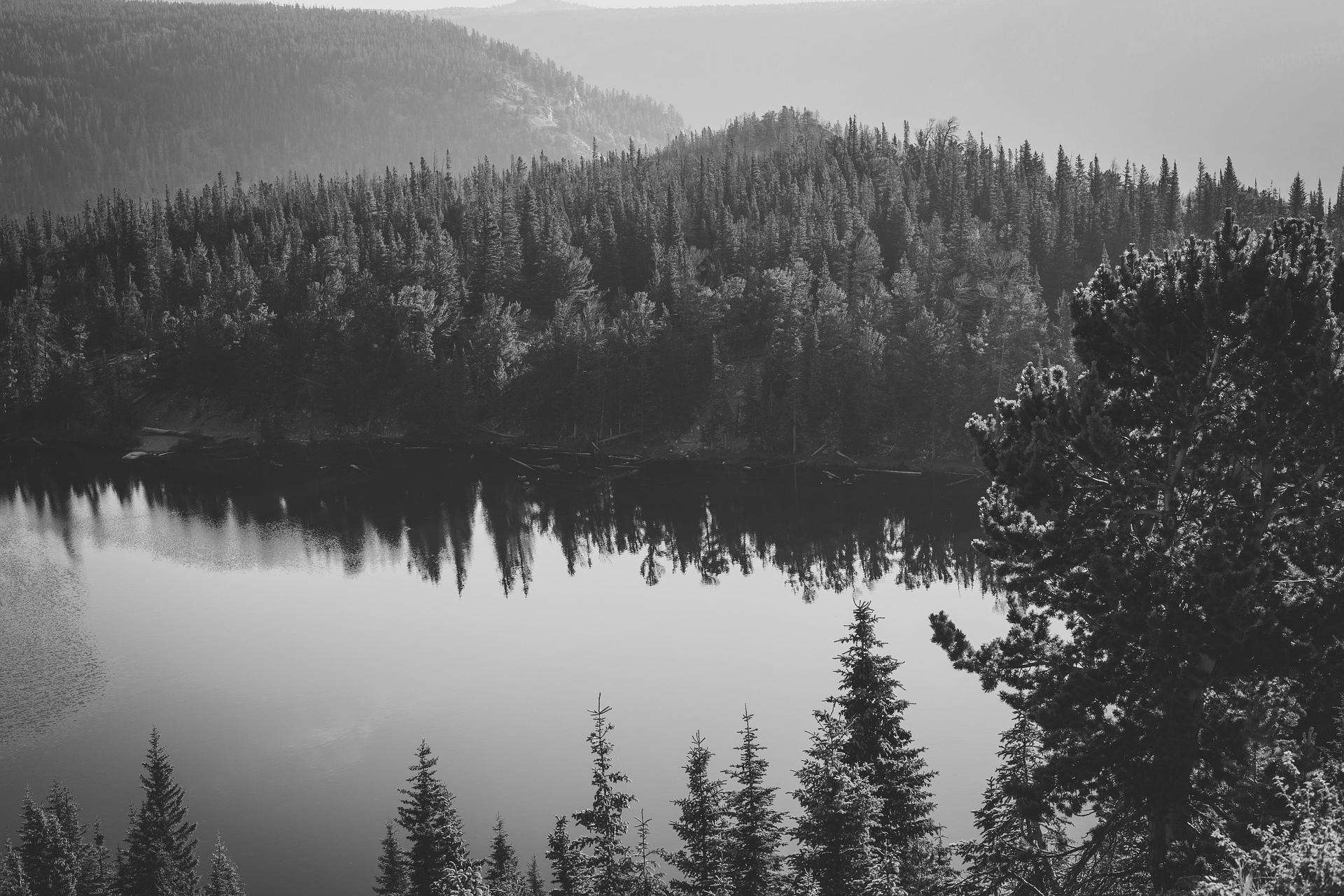
Eventually we were driving through a massive valley comprised of small meadows and creeks deep in the Routt National Forest. The trees disappeared and all we saw for miles were grass, flowers, and more grass. Once or twice the creeks would snake over the road. We welcomed the free car wash because let’s face it, it was hard to see the paint in certain places.
Lo and behold, in the middle of all this nothing and we arrived at a building of all things, a two story building at that. It was the Rock Creek Stage Station built in the 1880s that once was an operating stage stop, post office, hotel, and restaurant. It was a nifty little haberdashery, and so remote.


After a few more hours of driving, we entered the Radium Springs area on the Colorado River. We took a hike to the springs itself and then to the river to cool off in the ice cold snow melt.


We decided that this canyon we were in would make for a perfect camp. We were only at 7,500 feet so the weather would likely be more predictable. We had an entire valley to ourselves, free from other campers or anyone for that matter.


Day 6
Many miles of dirty roads were covered on this day. Waking up north of Gypsum and I-70, we were due to see civilization and modern conveniences at some point. Before we descended out of the mountains into the little mountain town, we drove through a sandy section that really had me wondering if we were in the right state. It looked much more like what you would assume Arizona or Nevada would look like. There were minimal trees, the creeks were dry, and there was lots and lots of sand.
After a stop at a gas station in town, we ascended back into the elevation, and pressed on. We did want to camp as close as possible to Leadville so we could do a nearby hike in the morning, so we ignored campsite after campsite trying to put miles behind us.
Once we got to about 9,500-10,000 feet above sea level, we started to seriously consider making camp, to avoid the weather as much as possible, which can get fairly wild up there in those high mountains. Not to mention, we were already on Hagerman Pass Road, which lead to a 12,000 foot pass through the mountains. So time was of the essence.
We finally found a spot to camp in an area called Hell Gap……wonderful. In all honesty, it was a beautiful campsite in a canyon surrounded by peaks. We got some hot dogs in us, and hit the sack, ready for our hike in the morning, or so we thought.


Day 7
Today was the most grueling day of the trip in terms of exercise and exhaustion. The goal of the day: get to the top of Colorado.
The highest point in the state and the second highest in the lower 48 states is Mount Elbert at 14,440 feet. We wanted to get to the top.
We woke up at 5:00am and had camp packed up by 5:30. We assumed that we would take 30 minutes to an hour to drive the gravel road up and back down the mountain and then perhaps another 30 minutes on the pavement to the trail head of Mt. Elbert. We didn’t arrive at the trail parking lot until 9am…..four hours after we packed up camp.

What slowed us down was the speed at which we had to travel to Hagerman Pass and back out of the mountains. The trucks rarely got above 5mph because of the terrain. There were rocks. There were ruts. There were steep drop offs that would send a car and its occupants to their deaths, and because of all this, we absolutely crawled this road. Many times from behind my vehicle I could hear the Subaru crunching and scraping along. He was low slung and had to pick near perfect lines to avoid rock damage, while the Chevys could lumber over everything as long as we were at a slow enough speed.
The hike we planned to do is the most difficult of the three main ways to summit Mt. Elbert, the Black Cloud Trail, a Class 2 climb. This 5.5 mile ascent climbs over a mile in elevation, so it’s essentially all a steep, uphill gradient.
It starts low in the valley at about 9,500 feet, and goes directly up the mountain to the top. The shade of the evergreen forest in the valley shielded us from the sun and was probably the easiest part of the trail in terms of strain on the body.


As we climbed higher in to the mountains, the air became thinner, the trees more scarce, and the shade disappeared. However the views were amazing, and we finally could see our goal, the summit.


I had never hiked anything like this before. The views were stunning and it was difficult to believe we were actually here. But my body was starting to notice exactly where we were. My legs began to get weaker and weaker and I slowed down to a snail’s pace. Eventually, I decided I was not going to make the summit, sat down for a moment to take it all in, and headed back down the mountain. I made sure to check my Gaia GPS to see how far I had made it, elevation wise: 13,000 feet. That was the highest I’ve ever been, and completely okay with calling it quits at that point.


Once I made it back to the trail head, 5 hours later, my smelly self drank water until it was coming out of my ears. I was really rooting for the other two guys that continued on without me to the summit and was anxious to see their pictures from the top.
To my surprise, they arrived back sooner than I expected. They informed me they had pressed on to 14,000 feet, but weren’t able to summit the mountain. Perhaps we were a bit in over our heads, but that’s alright. For some of us it would be the hike to remember.
Once we all recuperated with a bit of lunch, we began to plan out where we would camp. Initially we thought we could just camp at the trailhead, considering we were all beat tired. Privacy and space were a bit of an issue so we fired up the trucks, and sent them back onto the highlighted route looking for a camp in the Gunnison National Forest.


We descended into a valley called the Kentucky Gulch, and we couldn’t see a single person or vehicle for miles. In a corner near the forest, we found a campsite that was to be home for the night, sitting at 9,800 feet.


When the sun went down, the sky was filled with stars. We aren’t used to that, being from Atlanta and all the big city lights. However the serenity did not last. The stars began to fade as a massive mountain monsoon came in to the valley (how’s that for an alliteration?). We packed up everything but the tents so it wouldn’t get wet, and boy are we glad we did so.
We were drenched that night. The rain came down hard, the lightning lit up the tents and shook the air around us, and it began to feel as if we were actually inside the storm rather than under it. We survived, but that was definitely the most treacherous night of the whole trip.
Day 8
Today would be our last day with our friend in the Subaru. He had work the next day, so afterwords we packed up camp and milled around a little until he was on his way back to Fort Collins. Chevys only for the remainder of the trip!
The next two days would be the highlight of the trip in terms of scenery. We were getting close to Lake City, which is the start of the Alpine Loop. The Alpine Loop traverses through multiple 12,000+ foot passes to the towns of Silverton, Ouray, Telluride, and then back to Lake City. So we didn’t waste any time and hit the tracks.


We arrived in Lake City and I was immediately in love. Everywhere you looked there were Jeeps, ATVs, UTVs, trucks, and rental and repair shops for all. The town screamed exploration and adventure.

After we filled the gas tanks and visited the store, we were back on the tracks again looking for a camp. We put our trucks at the beginning of the Alpine Loop, ready for some sights! And we immediately found one, or should I say two?

The road up to Cinnamon Pass had a million steep switchbacks. Some were so tight we had to reverse and make up for the lack of a turning radius in these 4WD boats of ours. The mountains were incredible, some still covered in snow. We ascended Cinnamon Pass just before the sun went below the mountains and it was quite the view.


On the way down to the old Animas Forks mine, we were struggling to find a campsite, or at least one that wasn’t occupied. We drove into the night, tired, hungry, and ready for camp. And then it began to rain. We finally arrived at a grassy spot that would’ve been suitable for our tents. But we were exhausted. We unloaded the camp stove, slapped some chicken and hot dogs on it, ate, and slept in our trucks right where they were. Home is where you park it I suppose.
Day 9
We woke up in the Animas Forks ghost town this morning, and the weather was much better than when we arrived. It was amazing to see what the river valley looked like in the daylight, considering we pulled in to camp in the pitch black. The town still had plenty of structures standing, including a two story house, the jail, and the mine itself.


The history of this place is too fascinating to leave out, so in case you’re curious, I’ll provide the little blurbs about these historic sites.


After we walked around and checked out all of the old buildings, we bumped those keys to start the trucks and were off to California Pass, the highest point of the COBDR at 12,960 feet.

When we ascended to the top of California Pass, we had a bird’s eye view of the entire area. We could see mountains for miles and miles and miles as well as the the road we traveled on to get to this point. It’s truly amazing that we were seeing the same views from a road built in the late 19th century. Incredible.

After taking in the view and some pictures, we started to hear a sound coming from the Suburban. The slow hiss only meant one thing: he punctured a tire. But no bother. I broke out the tire plug kit, the tire was plugged and I had him aired up back to 30 psi in no time.
We continued down the mountain and the driver of the green monster came on the radio informing us he popped ANOTHER tire. Upon further inspection, we realized this one couldn’t be repaired on the trail. It was going to need a patch from the inside. We slowly rolled it to flat ground, or flatter ground I should say, and began to change his tire….at 12,000 feet above sea level.


Now that we had the Suburban in working order, it was time to fix the popped tire. Down in the valley was the town of Ouray. Once we arrived we pulled up at a car shop and had his damaged tire replaced and the spare returned to its home. He was ready for the road again!

We had one more high pass to summit before we made camp. So far, we had bagged California, Hurricane, Los Pinos, Hagerman, Cinnamon, Slumgullion, Cottonwood, Crooked Creek, Weston, Cumberland, and Corkscrew Passes. The last remaining one on our route was Ophir. To Ophir Pass and then to camp!


Our camp this night would be the highest of the trip: 11,500 feet. It had incredible views as we were perched on a cliff of sorts. We had green grass, a few trees for cover from the sun and wind, and flat spots to lay our tents. There was also an abandoned log cabin in the woods. I wondered who lived there last and why they didn’t any longer. What a harsh life they must have had living up here in these mountains alone. What was the story there? It’s likely no one will ever know.


Day 10
The driver of the Suburban had been complaining about a noise from one of his wheels throughout the day. He guessed that he had a rock in his brakes that was scraping around. To be sure, he jacked up the truck, took the wheel off, and started to inspect the rotor and the pads. He noticed the rotor was scratched up, but no rock wad to be found.
To figure out what it was we took it to a car shop in Durango. Their hypothesis was nightmarish. They thought his rear differential was bad, roughly a $2000 fix, and did not recommend he drive home to Atlanta in such condition. We had to get another opinion. Our other options included towing the truck home or worse abandoning it.
Luckily a member of the group had a friend in town, and he recommended a 4×4 shop nearby. This was a God send, especially after we heard their news. The only issue was a broken parking break that was ruining the rotor. The techs cut out the E-brake and replaced the rotor, and the truck was good as new for $200.
With all the mechanical drama really starting to stress us out, we decided this would be the end of the trip. The old Suburban had a rough trip and we concluded it wasn’t worth possibly breaking something else. We stayed in Durango that night and in the morning began our long journey home.
What an incredible trip:
8 nights in the woods, all between 7,500 and 11,500 feet up
12 high passes
500 offroad miles driven
Nothing short of unbelievable as far as a group of Georgia boys are concerned.
